Time-honored travel tribulations—We nearly come up short—The Socorro Mine—A California condor (or six)—A very rare rodent Sierra San Pedro Martir—Geological origins—A short lesson in biogeography—The ecotone—Unique inhabitants—La Tasajera—We miss lunch—Canyon tripping to La Grulla—A new landscape—Our new digs—I wish I could take a bath—Whitney’s diverse talents—We shake hands with the trout
3 June, 7am, Rancho Meling
Breakfast with Christian of eggs and beans, tortillas, and fruit—a pretty typical meal on this trip. Our plan today is to leave for the Parque Nacional Sierra San Pedro Martir, where we’ll meet Rolando at a place called Tasajera. He’ll transfer our gear to the pack train and walk us to La Grulla meadow.
This practice of securing transport into the mountains would have been all-too-familiar to earlier scientists. In 1925, while one could arrive at the Meling Ranch by car, the path up the mountains was only for pack animals. A trip that now takes about an hour and half on a paved road then took Lamb two hard days. But first he had to secure his pack train. This meant negotiating with locals. Every old field account I’ve read is filled with travel-related trials, from half a day wasted chasing down noncompliant “rather wild” pack animals that had run off with and smashed gear (5/8/1925), to long delays waiting for Mexican guides, to rather intense moments over payment for guides and animals. A sometime-colleague of Lamb’s, Laurence Huey of the San Diego Natural History Museum, recounts some colorful stories of dissenting burros trying to sneak out of line for a snooze or simply cantering off with a defiant “bray of joy” to be “seen no more” (6/9/23). At one point on Huey’s 1923 expedition, wrangling over the price of transport resulted in a two-day standoff with locals who “had an idea that we were very wealthy, placing their prices accordingly” (6/3/1923). Lamb, too, complained of payment issues, particularly when locals used American money, because they “charge American prices” (5/8/1925, 81-82). Where money was concerned, it was easy for congenial relations to sour quickly. In these moments, you can see the precarious intersection of science, economics, and national and local politics: American researchers arriving in a comparatively poor country trying to maximize scant research dollars confront locals who understand well the unevenness of the exchange, and who attempt to leverage it to their advantage.
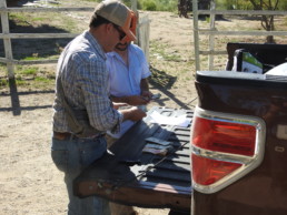
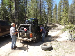
And so it’s only fitting that our own expedition’s only significant hangup to date has to do with money and transportation. After some last-minute packing we begin to settle the bill with Christian, who is to drive us to Tasajera to meet Rolando. Christian has contracted privately with Rolando for this trip. We’re to pay Christian for the entirety of it—in cash, which we do not expect. We don’t have enough US cash on hand, so we pool all our pesos and we’re only barely able to make up the whole amount. The scene is somewhat comical, if embarrassing: John and Christian standing at the back of Christian’s pickup truck, laying out US and Mexican bills down to the peso on the tailgate. But it’s also clear that Christian thinks our embarrassing lack of planning is in fact stinginess, perhaps even an attempt to shirk payment. There’s tension in the scene, and Christian’s mood, which had been to this point obliging and generous, turns a little dark, and it casts a shadow over the drive up to the entrance of the Parque Nacionale.
3 June, 9am, Socorro Mine
On the way, we pass Arroyo Socorro and the mine on the Observatory Road, the long-abandoned relic of the Johnsons’ industriousness. Christian lightens a little when we ask him about it. There had been a minor gold rush in Baja around the Johnsons’ time, in the context of a other extraction ventures in the mountains that included silver and copper, as well as onyx and marble. “Placer” gold had been discovered in the Arroyo in 1876 (Sanford 31). Placer gold is gold found in alluvial deposits, in the sand and gravel washing down canyons through natural erosion. Placer mining is employed when the rock can’t support tunnels. Sluices or small dams installed at canyon bottoms control the flow of water through the richest deposits. A gravel-and-water slurry collects in the sluice box, a kind of chute trapping the slurry. Heavier metals sink to the bottom, where they can then be harvested. In this way, Johnson and his crew of Kiliwa Indians extracted $250,000 over about 15 years from Socorro, otherwise known as “Canyon de Rica”—enough to pay labor, buy new equipment, dig reservoirs to capture runoff water, and in 1893 carve an 18-mile sluice channel (“ditch”), a small “masterpiece of contour engineering…dug out of solid rock with blasting powder and pick and shovel” (Sanford 32).
Placer mining requires a lot of water, a scarcity in this region. To get it, Johnson’s ditch diverted it from another watershed, the Rio San Rafael (Minnich 642). Not content to rely only on seasonal rains to wash down the deposits, Johnson even turned to modern technology, hydraulic mining, a highly destructive extraction process that involves shooting pressurized water through a hose with the diameter of a dinner plate to scour gravel off the canyon walls and down into the sluice box. In this way, the process takes canyon walls down to the bedrock, eliminating the canyon banks and with them any substrate for anchoring vegetation and—ultimately—habitat.
When hydraulic mining ceased to be productive, Johnson resorted to more ancient technologies to extract the last bits from the hillsides. He built an arrastre, a method for grinding rocks “by placing small ones within a circle of large ones and dragging bigger rocks over the ones to be ground up, round and round, until both are powdered and the gold is freed from the base rock and can be recovered by panning” (Sanford 49). The entire operation was hugely labor intensive and would not have been possible or lucrative without the help of the native Kiliwa.
Johnson’s mine qualifies as “unusually productive,” worth the cost of development, and therefore anomalous in a region where most other industries failed (Nelson 9). The regional history—and the landscape—is dotted with the relics of these failures. Edward Nelson, surveying the region in 1905-06 for his Lower California and Its Natural Resources, noted these failures: abandoned ranches and mines, discarded machinery, deserted buildings and fields. Nelson attributed such failures to the region’s forbidding desert character: water scarcity, fuel (wood) shortage, and winds blowing down from canyons so hot that it “seemed to come direct from a furnace” (27). Combined with aggressive Indians and the absence of good roads, industry in the mountains was all but impossible.
After Harry’s death and the war that burned the Johnson Ranch, the mine was never reopened. Bertie Meling attributes this to the loss of Harry’s ingenuity and drive, but perhaps more to the point was the loss of native labor after the reforms of 1910-11, and new, post-Revolution water laws that restricted water diversions across watersheds. Changes to the political character of the landscape made placer mining essentially impossible.
3 June, 10am, Condor Lookout
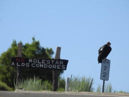
A few miles beyond, we approach a hairpin turn and my first thought is why someone has slung a huge black trash bag over the kilometer marker. This bag turns out to be a California condor! A group six of them are hanging out at a pullout overlook. Park officials put carrion here to attract these primeval birds. In an act of obvious overt defiance, a few more perch near a sign that reads No Molestar los Condors. We drive past the first bird within just a few feet. I might have reached out and touched it. A number of turkey vultures also take advantage of the free meal. These birds—impressively large in their own right—are dwarfed by the condors. The condors are huge black birds with a white stripe on the underside of their massive wings that makes them easy to distinguish from turkey vultures in the air. Their featherless pink-gray-orange-mottled heads, small eyes, and large hooked bill are designed for digging deep and tearing into a carcass. These undertakers are a huge success story in the Sierra San Pedro, which has a condor sanctuary managed by the San Diego Zoo. Five California condors were sent to the Sierra in 2002, and in 2013, two chicks were successfully fledged there. By 2015, there were 28 condors in the Parque; today there are 36. Some of them are untagged juveniles, which means they were fledged in the wild.

3 June, 10:30am, Parque Nacional entrance
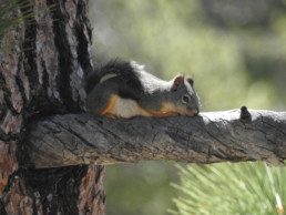
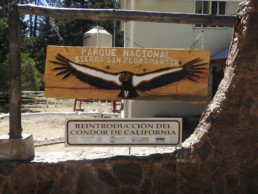
Farther up, past the Park entrance, we pass the tree line and officially enter the high-elevation pine forest. When we stop briefly to coordinate with Rolando, we happen to observe—and record for the first time ever on video—the Mearns’s squirrel (Tamiasciurus mearnsi), an endangered endemic arboreal squirrel limited to this small portion of the mountain range.
Lamb and Grinnell called these squirrels “Sierra chickarees” and observed them similarly laid out flat on horizontal pine branches. They were alerted to the animals by the husked pine cone cores scattered at the base of the “shelling trees” where they perch (Grinnell 10/3/1925, 2565). This squirrel might have been separated from the two other close relations, the Douglas Squirrels and Red Squirrels, for about 12,000 years. Unlike those, this one exhibits nonterritorial behaviors: they don’t “build or defend larder hoards” or middens, and don’t build nests, preferring instead to live in tree hollows. These nesting habits may affect the animal’s range, distribution, and behaviors normally associated with defending a nest. The squirrel seems smaller than a Douglas, and is marked by a white belly divided from a gray back by a distinct black band. It has a distinctive white ring around its eye and a scant tail. We observe this animal a few more times on the trip and in almost all cases, it lay high up on branches of Jeffrey Pines, close to the trunk, usually hugging its branch. http://arizona.openrepository.com/arizona/handle/10150/228171
In some ways, passing the Parque entrance and seeing these two rare charismatic creatures—one endangered, the other endemic, but both at the same time very familiar to anyone living in California—marks the end of our prologue and the true beginning of our expedition. They signal some of what is special in this mountain range, why the Park created for its protection exists, and why we’re about to go to so much trouble to document it. But to understand some of this specialness requires context, both in terms of space and time. Like many landscapes in California, time is especially visible here. Traveling the Observatory Road from the coast up into the park, toward the higher mountain plateaus and meadows, is like reading a book of California’s deep history. It’s a journey of just over 100km but it took about 66 million years to make, and it will take a few paragraphs to begin to appreciate.
The Sierra San Pedro is part of the Peninsular Range that runs north-south along the center of the Baja Peninsula. It is continuous with the Sierra Juarez immediately to the north, which is continuous with the San Jacinto Mountains across the border. The Sierra San Pedro Martir is the “southernmost outpost of the Mediterranean vegetation of the California floristic province” (Minnich 627). If we made state boundaries coterminous with regional flora and fauna, this one would extend from the Sierra San Pedro in Baja to the Cascades in southern Oregon. This means that there is significant biological continuity along the chain of mountains that extends the entire length. “Nearly all tree species” of this province, including the oak woodland and chaparral species common throughout California, “have their southern limits” in the Sierra San Pedro. Most of the birds you’ll see in the San Gabriels or the Sierra Nevada you’ll also find here.
How Alta and Baja California came to share this biodiversity was the hot question driving much scientific exploration in the early twentieth century, and the very reason Grinnell gave the Sierra the highest priority during his time as Director of the Museum of Vertebrate Zoology at Berkeley, which funded Lamb’s expeditions in the south.
Grinnell believed, as did many at the time, that Baja rose from the sea, “probably only segments of it at a time,” like islands. As it did, it “filled with invasions from its northern base”–or Alta California–migrating southward. Grinnell may have gotten his idea of island invaders from Nelson, who postulated the same idea two decades earlier (Nelson 53), but the belief in Baja’s island past goes deep into the history of New World exploration: Before the twentieth century, the first Europeans to arrive at the southern tip of Baja represented the entire peninsula as an island, clearly not having circumnavigated or even seen it (the name “California” may be an act of imagining place: it was the name of a fantastical island in a 1510 work of romance by Garci Rodriguez de Montalvo [Simpson 19]).
We now know that Baja was once attached to the Mexican mainland. Like southern California, the Peninsula sits on the Pacific plate, which slides northward along a transform or strike-slip fault. We call this fault the San Andreas in Alta California, where it runs along the north side of the San Gabriels and west of the San Bernardino Mountains. The Baja Peninsula detached from mainland Mexico along this fault fairly recently, during the Cenozoic era starting 66 million years ago, slipping northward and opening up the Gulf of California. Its mountains, the Sierra San Pedro and Sierra Juarez, were produced more recently, around 30 or so million years ago by the same tectonic uplift that produced the Sierra Nevada. When the ancient Farallon Plate subsided beneath the North American Plate, it melted in earth’s hot mantle and belched up gigantic magma bubbles called plutons that cooled into the huge metamorphic deformations we know as mountains. So in contrast to the island theory, the peninsula existed long before its mountains. Alta and Baja California therefore have shared an exchange of flora and fauna for a long time.
This means is that northwestern Baja is “Nearctic,” or part of the North American faunal and floral region, and not “Neotropical”, or part of Central and South America. But even before the discovery of plate tectonics in the 1960s, Grinnell postulated based mainly on the basis of bird distribution that this was so, despite that his geology was wrong. He wrote:
One thing, perhaps more than anything else, has resulted from our work so far in Lower California, and that is the conviction that the entire peninsula of Californian in faunal affinities; it is not Mexican. Save for a very few vagrant types among birds, and only certain bats among mammals, the entire bird and mammal fauna of the peninsula seems to have been derived from the north (12/2/26).
Grinnell’s claim that Lower California “belongs” to the north may be another in a succession of colonial arguments–not all of which come so overtly packaged as Sanford’s Where the Old West Never Died. Grinnell’s scientific terms carry perhaps more political than geographical signficance, slipping easily into defining “faunal affinities” in political terms (Californian/Mexican), like an ecological annexing as a companion to the cultural annexing going on in Bertie Meling’s narrative.
Furthermore, they don’t convey an understanding of deep time necessary to reveal that Baja, geologically, is Mexican, in so far as the peninsula was once attached to the Mexican mainland. But his sense that ecology doesn’t naturally end at political borders was correct. (However, the unevenness of land development north and south of the U.S./Mexican border does nowadays signal the end of one kind of place and the beginning of another–one of the reasons we’re on this expedition to begin with.)
Probably because the two share this geological relationship, the Sierra’s geographical character looks a lot like a smaller version of the Sierra Nevada to the north: it is a high, dramatic range of granite with a long western slope rising from the west coast that terminates abruptly at a jagged crest that tops out at 10,000ft, and then plunges precipitously down a near-vertical eastern escarpment to the San Felipe Desert. The crest of the Sierra is “a broad plateau consisting of shallow alluvium-filled basins and extensive meadows,” of which Vallecitos (2400m) is the highest, followed by La Grulla and La Encantada (2200m), and Arroyo Santa Eulalia (1600m). Below these high basins, the range is “rimmed by the extensive plain of Valle San Telmo,” which we drove through to get to Rancho Meling: a long, wide valley running east-west that follows Rio San Telmo, the same watershed that connects San Telmo and San Jose Valleys. Arroyos like Rio San Telmo wind down the long western slope, eventually emptying into the Pacific. Most of these are seasonal, and water only makes it to the ocean in seasons of heavy rainfall.
As Grinnell intimated, this geology is important because it has resulted in “a very diverse geographic layout” (Cartron 26) that promotes a high degree of biodiversity, especially in the “arid, northern part of the country” (3) that includes the Sierra San Pedro. These alluvial basins and meadows, extensive mesas, and arroyos provide rich diversity of habitat that probably accounts for the region’s higher biodiversity in birds, mammals, and plants than the rest of the peninsula (Minnich 637). Northern Baja alone accounts in large part for Mexico’s status as one of the world’s 17 “megadiverse” countries. Here, “the Neotropic and the Nearctic regions merge,” producing what ecologists call an “ecotone,” a unique blend of plant and animal communities composed of species from both the northerly and southerly biomes, mingling to create subspecies of more common species on either side. The result is that “the percentage of endemic species is surprisingly high for a country that is part of a continent” (Cartron 3).
This ecotone is the reason Grinnell devoted so much of his resources to it—so much he began simply to referring it as “our ‘section’” when describing the 32nd parallel, from San Quintin on the western coast of the Baja peninsula, over the Sierra San Pedro Martir, down to San Felipe on the Gulf coast. This he believed was a critical region where the San Quintin and San Pedro Martir faunal regions begin to merge with the San Ignacio and Cape regions to the south (4/25/25, G to Alexander; 6/3/25, G to Lamb; 11/5/25 G to Alexander; 8/15/30 G to Alexander).
The Sierra alone is home to 20 subspecies of endemic birds, and 5 species and 3 subspecies of endemic mammals, including Mearns’s squirrel. Its megafauna includes mountain lions, mule deer, and rare mountain sheep. It is the type location of the endemic Baja rainbow trout—the reason we’re lugging along our fly rods—and a native habitat of the California condor. Its flora is even more diverse. It hosts 15 species of endemic plants in an array of plant communities. Following the western slope from the coast to Vallecitos, the plant communities represent just about every one common to California: from coastal chaparral along the lower elevations on the west coast, to desert scrub and chamise chaparral at the mid-elevations, to manzanita and pinyon pine and then conifer forests higher up the range. It will be a challenge to try to distinguish some of the keystone species in each.
As with many other regions of high biodiversity, including Alta California, where some 90% of the unique coastal habitat has been lost, “northern Mexico’s biodiversity is now threatened” by development, habitat loss, the introduction of exotic (non-native) species, and other anthropogenic impacts (4). One of the outcomes of a comparative biodiversity survey like ours is the assessment of these impacts over time.
3 June, 1pm, La Tasajera to La Grulla
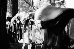
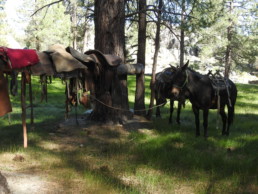
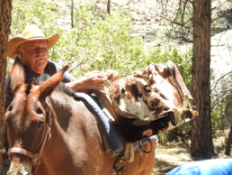
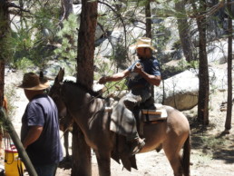
We meet Rolando at the drop point, called La Tasajera—a small meadow with a dirt road into the forest that leads to the trailhead that will take us to La Grulla. He and Christian load up Rolando’s Ranger with our gear. Rolando tells us we can walk and bird for a few of miles and meet up with his team at the road’s end, where they’ll be waiting to take us down the canyon into La Grulla. After this point, we’re on foot and hoof: We’re leaving behind the luxury of modern roads and are about to experience the timelessness of the pack train.
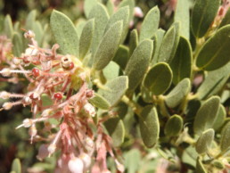
From a natural history point of view, this is one of most diverse and most interesting canyons I’ve ever toured. It’s a 4-mile walk that descends steeply with about 2000’ of elevation loss, through at least three different plant communities. The canyon’s south-facing aspect means that it gets and stays hot and dry, so it demonstrates an arid micro-ecology of canyon oaks and manzanitas and sage in between the conifers at the plateaus above and below. White fir and gangly sugar pines gradually give way to canyon live oaks and a couple of species of manzanita: one, the green leaf manzanita (Arctostaphylos patula), with waxy leaves, and the other with a fine coating of hair on the leaves and stem ends, like the Arctostaphylos glandulosa familiar to me from walks at higher elevations in southern California. Near the bottom, we begin to see a species of rare Rose Sage, a California native only found in pine forests at higher elevations, and hardly beyond California’s borders. It has soft green lobed leaves and large violet inflorescences that look like roses, but which are actually not the flowers. Like one flower emerging from another, the sage produces two small blue, 2-lipped flowers, opposite each other on each inflorescence. These were just coming into bloom during our visit. Southern sagebrush lizards and granite spiny lizards scurry up and down the hot boulders, while scrub jays shriek loudly overhead.
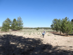
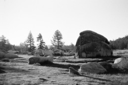
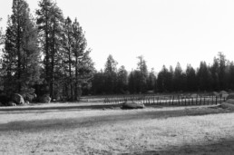
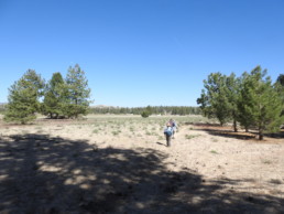
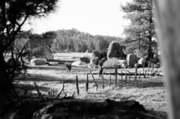
The canyon empties into a large grazing meadow to the north of La Grulla—a wide, flat, sandy plane bordered with pines and a bouldery granite rim beyond those. The meadow is a massive grassy llano dotted with granite boulders that somehow made their way into the middle, perhaps as the hard kernels of much larger features left behind from erosion, or having been moved there by perhaps some early glacial action—this latter interpretation is hard to square with the Sierra’s history of aridity: I doubt there were ever glaciers here to move such massive boulders.
The meadow is criss-crossed with fenceposts and barbed wire separating the llano into grazing pastures. Giant, petrified cow patties cover the ground in every direction, rising out of dense, soft grass and spiny thistle that hosts a variety of butterflies, from Western Tiger Swallowtails to various species of Vanessa.
The experience of walking into the meadow after the narrow canyon confines is one of intense exposure—the massive blue sky opens up and the landscape seems to spread out all around in 360 degrees. Despite the meadow’s pleasant flatness, walking through its sandy bottom is like trudging on a beach, and less preferable to the steep but firm-footing of the canyon.
3 June, 4:30pm, La Grulla and Camp
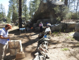
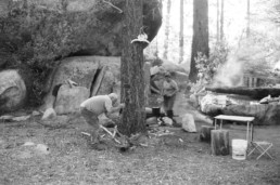
When we arrive at camp, the cooking is on. Camp is a pine-shaded, stream-side bower with a massive granite boulder formation that functions as kitchen and middens. A large, flat granite slab provides a surprisingly effective prep surface. The stream seems pleasant at first, with water flowing from the meadow to the north, down through a forest of willow to the south. In between, just near camp, the stream fills a large granite bowl. Rolando and his team keep their horses tied up in the stream bed, so the water is less than inviting, and my dreams of a cool stream bath after a long hot trek quickly dry up. Rolando, on the other hand, seems to have fewer reservations: he simply gathers water from the stream in a 5-gallon bucket without a thought! It goes straight to the kitchen, so I guess we’ll be drinking this water after all.

We’re tired and hungry after the walk, but dinner is another two hours away. We go naturalizing to distract ourselves. Whitney and I get to shooting a few birds, some lizards, and a mammal or two. We’re teaming: one of us will aim the camera while the other circles the hiding place of a squirrel or lizard. It’s a pretty effective way to scare up wildlife, and fun.
Whitney’s been working for John at the Lab for five years, since graduating from Occidental with a degree in biology. Since working for John as Lab Manager, she’s taken up birds, but she started out in marine biology, being from Seattle—and she’s a former college swimmer, so she seemed destined for the water in one way or another. However, her level of expertise belies this late shift in focus. She’s as finely tuned to the bird life as either John or James and, being a patient teacher, gives me some good tips on observing birds.
3 June, 6:30pm, Camp
Dinner consists of beans, rice, and machaca, or Mexican dried beef, which we secured before leaving Ensenada. This really hits the spot after our long walk without lunch! We filled fire-warmed tortillas with the machaca and chatted with the pack crew—which is Spanish only. This makes camp a little uncomfortable. John is the only Spanish speaker in the group (James and Whitney both are proficient, but they let John do the talking). But Rolando and Aede are kind and sociable and later Rolando sits by the fire with us, despite the language barrier.
After, we have daylight enough to fish the small granite bowl—our first chance to see the Baja rainbow trout. After some desperate searching I realize that I’ve left my fly reel at home! Having packed and re-packed my gear, I must have left it in a spare Action Packer. This is a real disappointment, but both James and Devon have along their rigs, so it isn’t a total loss. The marshy, algae-covered pool is deep despite its smallness. James hooks the first trout, Devon next, then I fish on Devon’s rod and snag two beautiful, small trout. All are between 5 and 8″. Like other mountain trout, they are feisty but naive: they see few fishermen and so are easy to snag. They are much darker than rainbows, a deep blue/purple. I catch mine dry flies, James on a nymph.
Later, we sit by a large fire sipping whiskey. James and John try to lure owls with iPhones. James notes that the idea is to start out with small-owl calls and work your way up to larger ones, on the principle that by doing so, you don’t spook the small owls into quiescence. If they think there’s a large owl around, they will stay silent for fear of being eaten.
In bed by 11:30pm.

